When Panchet Dam was formally inaugurated in December 1959, a young Santhal woman named Budhni Mejhan was chosen for what should have been a moment of pure celebration — garlanding Prime Minister Jawaharlal Nehru to mark the completion of one of independent India’s flagship development projects. Instead, that single ceremonial gesture, interpreted through Santhal tribal custom as a symbolic marriage, led to her being ostracised by her own community for decades. Her story remains one of the most quietly devastating human footnotes attached to any major Indian dam.
Panchet Dam: Overview
| Parameter | Details |
| State | Jharkhand (Dhanbad district) and West Bengal (Purulia district) |
| Location | Panchet |
| River | Damodar River |
| Dam type | Earthen dam with concrete spillway |
| Height | 45 metres (147.64 ft) |
| Length | 6,777 metres (22,234 ft) |
| Base width | 10.67 metres |
| Spillway capacity | 17,853 cubic metres/second |
| Year opened | 6 December 1959 |
| Owner/operator | Damodar Valley Corporation (DVC) |
| Position in DVC chain | Fourth and last of the four first-phase multipurpose dams |
| Reservoir active capacity | 1,497.54 million cubic metres |
| Reservoir surface area | 27.92 sq. km |
| Installed power capacity | 2 x 40 MW (80 MW total) |
| Notable submerged site | Telkupi, ancient capital of the Tilakampa Kingdom |
| Historical region | Former Panchet Raj princely estate |
| Nearby attractions | Garh Panchkot ruins, Joychandi Pahar, Pancharatna Temple |
| Best time to visit | October to February |
The Damodar River and Panchet’s Place in the DVC Chain
Panchet Dam is built directly across the Damodar River, unlike its three companion dams — Tilaiya, Konar, and Maithon — which were built across the Damodar’s tributaries. Completed and opened on 6 December 1959, Panchet was the fourth and final structure in the Damodar Valley Corporation’s first-phase multipurpose dam programme, a project explicitly modelled on America’s Tennessee Valley Authority and aimed at flood control, irrigation, and hydroelectric power across the historically flood-prone Damodar basin.
A few points about its role in this broader system:
- The Damodar was once notorious for severe, unpredictable flooding, and the combined effect of Maithon (1957) and Panchet (1959) significantly reduced both daily and annual discharge variability
- Statistical analysis of flood patterns shows that ten-year recurrence interval floods were effectively reduced to half their previous severity following these two dams’ completion
- As the last dam in the sequence, Panchet’s completion marked the culmination of the DVC’s original founding vision, closing a project that had begun with Tilaiya’s 1953 inauguration
The Story of Budhni Mejhan
Panchet Dam’s most significant human story doesn’t concern displacement or engineering — it concerns a single ceremonial moment during the dam’s 1959 inauguration. Budhni Mejhan, a young Santhal woman employed on the dam’s construction workforce, was selected to formally garland Prime Minister Jawaharlal Nehru as part of the official opening ceremony.
What followed reveals a painful collision between national development symbolism and local tribal custom:
- Within Santhal tradition, the act of a woman publicly garlanding a man in this ceremonial manner carried the social meaning of marriage
- Since Nehru could not, of course, actually marry her, Budhni’s own community interpreted the situation as leaving her in an impossible social position, and she was subsequently ostracised as an outcast by her village
- In 1962, the Damodar Valley Corporation itself terminated her from her staff position
- It was not until 1985 — more than two decades later — that then Prime Minister Rajiv Gandhi personally intervened to reinstate her at the DVC
- Despite this formal reinstatement, Budhni Mejhan and her daughter remained social outcasts from their own village community
This story has since become a significant point of reference in discussions about the human cost borne by tribal and indigenous communities during India’s major post-independence development projects — a cost that, in Budhni’s case, had nothing to do with land submergence or displacement, but with the collision between state ceremony and deeply held local custom.
What Was Lost: Telkupi and Its Ancient Jain Temples
Panchet Dam’s reservoir claimed more than agricultural land when it filled — it submerged Telkupi, a village under Raghunathpur police station that had once served as the capital of the ancient Tilakampa Kingdom. Telkupi was home to the ruins of Jain temples dating back to the 1st century CE, structures representing nearly two millennia of continuous religious and architectural heritage before they disappeared beneath the reservoir’s waters.
A few points about this loss:
- The submergence of Telkupi represents a genuine archaeological and heritage loss, removing physical access to structures that had survived for close to 1,900 years before the dam’s construction
- This kind of heritage submergence, while less frequently discussed than agricultural displacement, reflects a recurring pattern across several major Indian dam projects, where historically and archaeologically significant sites have been lost beneath rising reservoir waters
- The broader Panchkot region, of which Telkupi and the Tilakampa Kingdom formed a part, carried substantial historical weight well before the dam era, adding genuine depth to what the area lost during this period of infrastructure development
A Princely Estate Long Before the Dam
Panchet’s history stretches back centuries before Damodar Valley Corporation engineers ever arrived. The Panchet estate, also known as Panchet Raj, was a substantial princely estate in British India, encompassing Manbhum and portions of the Burdwan, Bankura, and Ranchi districts — a territory spanning approximately 1,254,172 acres across 22 parganas.
A few points about this deeper historical layer:
- By the start of British colonial administration, the estate had already lost clear traces of its earlier ruling chiefs, having likely formed through the consolidation of smaller zamindaris over time
- The ruins of Garh Panchkot, capital of the related Panchkot Raj, sit at the foothills of Panchet and remain a notable heritage site today, distinct from the submerged ruins at Telkupi
- This region’s genuine ethnic and cultural diversity, home to numerous tribal communities and local populations, predates and long outlasted the various political configurations — princely estate, colonial district, modern state — that have governed it over the centuries
Engineering Specifications and Flood Control Impact
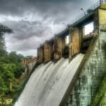
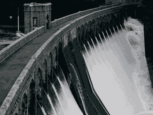
Panchet Dam is built as an earthen structure with a concrete spillway, standing 45 metres (147.64 ft) tall and stretching 6,777 metres (22,234 ft) in length, with a base width of 10.67 metres.
Core specifications:
- Height: 45 metres (147.64 ft)
- Length: 6,777 metres (22,234 ft)
- Spillway capacity: 17,853 cubic metres per second
- Reservoir active capacity: 1,497.54 million cubic metres
- Installed power capacity: 80 MW (2 x 40 MW)
As the concluding structure in the DVC’s four-dam first-phase network, Panchet’s flood-moderating contribution, combined with the earlier Maithon Dam upstream, has been central to transforming the historically flood-prone Damodar basin into a considerably more manageable and predictable river system.
A Note on River Safety
Given Panchet’s role in regulating flow along the Damodar, water releases from DVC dams can significantly affect downstream river conditions, sometimes with little warning. Local reporting has documented incidents where individuals bathing in the river were swept away by sudden strong currents linked to DVC water discharge combined with heavy rainfall, in one case a person carried nearly 45 km downstream before being rescued. This is worth keeping in mind for anyone visiting the Damodar’s banks near Panchet or further downstream, particularly during monsoon season when coordinated dam releases can raise water levels quickly.
Planning a Visit to Panchet Dam
For anyone considering a trip:
- Getting there: The dam sits at Panchet in Dhanbad district, near the West Bengal border, accessible by road from both Dhanbad and Asansol
- Best season: October through February offers comfortable weather and typically a well-filled reservoir following the monsoon
- Combine with regional heritage: The ruins of Garh Panchkot, Joychandi Pahar, and the Pancharatna Temple all sit within reasonable distance, offering a fuller regional itinerary covering both engineering and ancient heritage
- River caution: Given the documented risk from sudden water release-driven currents, exercising caution near the riverbank, particularly during and after heavy rainfall, is a sensible precaution
FAQs
Q1. What actually happened to Budhni Mejhan after she garlanded Prime Minister Nehru at Panchet Dam’s inauguration?
Following the ceremony, Santhal tribal custom led her own community to interpret the garlanding as a symbolic marriage, resulting in her social ostracism from her village; she was later dismissed from her DVC job in 1962, and though Prime Minister Rajiv Gandhi reinstated her at the DVC in 1985, she and her daughter remained outcasts from their community.
Q2. Are the ancient Jain temple ruins at Telkupi still visible today, or fully submerged?
The ruins, dating back to the 1st century CE and once part of the Tilakampa Kingdom’s capital, were submerged when Panchet Dam’s reservoir filled, meaning they are not accessible for viewing under normal reservoir conditions.
Q3. Is Panchet Dam connected to the other DVC dams like Maithon and Tilaiya?
Yes — it was the fourth and final dam built as part of the Damodar Valley Corporation’s coordinated first-phase multipurpose project, working alongside Tilaiya, Konar, and Maithon dams to manage flood control and power generation across the broader Damodar river basin.
Q4. Is it safe to swim or bathe in the Damodar River near Panchet Dam?
Caution is strongly advised, since documented incidents show that sudden water releases from DVC dams, especially combined with heavy rainfall, can create dangerously strong currents with little warning, so avoiding unsupervised swimming or bathing in the river is a sensible precaution.