Not every drop of water in the Vaigai River actually started its journey there. A meaningful share travels from Kerala’s Periyar River, cut through a tunnel bored straight into the Western Ghats over a century ago, before ever reaching Vaigai Dam near Theni. This quiet interstate water transfer is one of the least-known facts about a dam that six Tamil Nadu districts depend on for both farming and drinking water — and it’s exactly the kind of engineering backstory that makes Vaigai Dam more interesting than its modest height and length might suggest.
Vaigai Dam: Quick Overview
| Parameter | Details |
| State | Tamil Nadu |
| District | Theni |
| Nearest towns | Periyakulam and Andipatti |
| River | Vaigai River |
| River origin | Varusanadu Hills, Western Ghats |
| Dam type | Gravity dam |
| Height | 33.8 metres (111 ft) |
| Length | 3,560 metres (11,680 ft) |
| Storage capacity | 174 million cubic metres (6.14 TMC ft) |
| Construction cost | Rs 10 lakh (at time of construction) |
| Built by | Public Works Department, Madras Presidency |
| Inaugurated | 29 January 1959, by Chief Minister K. Kamaraj |
| Power station commissioned | 3 April 1990 |
| Installed power capacity | 6 MW (2 x 3 MW turbines) |
| Power operator | Tamil Nadu Green Energy Corporation Limited |
| Districts served | Theni, Madurai, Dindigul, Sivagangai, Ramanathapuram, and others |
| Special water source | Supplementary inflow from Periyar River (Kerala) via Western Ghats tunnel |
| Notable engineering trait | Not built between two mountains — relies entirely on concrete gravity strength |
| Nearby facility | Agricultural Research Station studying rice, sorghum, cotton, and pulses |
| Recreational features | Riverside park, children’s play area, musical dancing fountain |
| Best time to visit | November to February |
A River That Isn’t Entirely Its Own
The Vaigai River begins its life in the Varusanadu Hills of the Western Ghats, flowing north through the Cumbum Valley before turning east across the Pandya plains and eventually reaching the Palk Strait near Ramanathapuram. On its own, the Vaigai is a semi-perennial river, meaning its natural flow alone wouldn’t reliably sustain irrigation across the arid, rain-shadow districts it passes through — a real problem for a region that includes some of Tamil Nadu’s driest agricultural belts.
The solution came from an unusual source: water diverted from the westward-flowing Periyar River in Kerala. The idea of redirecting Periyar’s water eastward into the Vaigai basin was first proposed as far back as 1789 by a minister serving the Ramnad kingdom, though it was abandoned at the time as too expensive. It would take over a century of British-era engineering, culminating in the Mullaperiyar Dam project, to finally realise this interbasin transfer through a tunnel cut directly through the Western Ghats.
What this means practically for Vaigai Dam today:
- A portion of the water reaching the reservoir originates outside Tamil Nadu entirely, having crossed state lines through Kerala’s Periyar system
- This supplementary flow significantly increases the reliable water available for Vaigai’s command area, compensating for the river’s naturally limited catchment
- The arrangement remains a long-running subject of interstate water-sharing discussions between Tamil Nadu and Kerala, given how central the Mullaperiyar-Vaigai link is to both states’ water politics
A Dam Built to Stand Alone
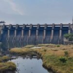
Most large gravity dams anchor themselves between two hills or a narrow valley, letting the surrounding terrain share some of the structural load. Vaigai Dam is unusual in this respect — it’s one of the few Indian dams not constructed between two mountains, meaning its entire ability to hold back the reservoir depends purely on the strength of its own concrete gravity structure rather than any assistance from the landscape around it.
This engineering choice reflects the terrain near Periyakulam, where the valley simply didn’t offer the kind of natural rock anchoring that dam builders typically look for. Instead, engineers built:
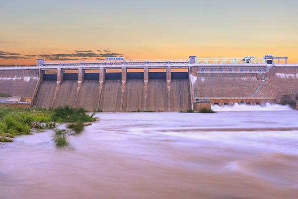
- A gravity dam standing 33.8 metres tall
- Stretching 3,560 metres in length, a considerable span for a dam relying entirely on its own mass for stability
- Designed to hold a reservoir capacity of 174 million cubic metres (6.14 TMC ft)
The result is a structure that has held steady since 1959 despite lacking the geological support many comparable dams rely on — a point of quiet engineering pride for a project built on a modest construction budget of just Rs 10 lakh at the time.
History: A Post-Independence Priority for a Drought-Prone Region
Vaigai Dam was constructed by the Public Works Department of the Madras Presidency and formally inaugurated on 29 January 1959 by then Chief Minister K. Kamaraj — the same leader associated with several major water infrastructure projects across Tamil Nadu during this period. The dam’s construction addressed a longstanding regional problem: the districts along the Vaigai’s course, particularly around Madurai and further south toward Ramanathapuram, sit in a rain-shadow zone where monsoon rainfall alone had never been dependable enough for consistent agriculture.
A few historical points worth noting:
- The area falls within what was historically Madurai district under British India, before Theni district was carved out separately in 1997
- The dam’s construction coincided with broader efforts across post-independence Tamil Nadu to secure irrigation water for chronically dry southern districts
- Its low construction cost by later standards reflects both the era’s economics and Vaigai’s relatively modest scale compared to larger contemporaneous dam projects elsewhere in India
Engineering and Reservoir Specifications
Beyond its unusual standalone construction, Vaigai Dam’s core specifications place it as a mid-sized but strategically vital reservoir:
- Height: 33.8 metres (111 ft)
- Length: 3,560 metres, making it a fairly long structure for its height
- Storage capacity: 174 million cubic metres, equivalent to roughly 6.14 TMC ft
- Dam type: Gravity dam, generating hydroelectric power in addition to its irrigation role
These figures position Vaigai as a dam whose value lies less in raw scale and more in precisely where it sits — controlling water access for a river system that six districts depend on collectively.
What Six Districts Owe to This Single Reservoir
Vaigai Dam is frequently described as the lifeline of the region it serves, and the description holds up under scrutiny. The dam’s water reaches:
- Irrigation networks across Madurai and Dindigul districts, supporting crops that would otherwise struggle against the region’s limited and unreliable rainfall
- Drinking water supply for Madurai city and Andipatti town, both significant population centres
- Broader agricultural support across Theni, Sivagangai, and Ramanathapuram districts as the river continues its course toward the coast
Near the dam site, the Tamil Nadu government has also established an Agricultural Research Station dedicated to studying crops suited to the region’s conditions, including rice, sorghum, black gram, cowpea, and cotton — a direct acknowledgement of how closely this dam’s water management ties into the region’s farming outcomes.
Power Generation: A Later Addition to an Older Structure
While Vaigai Dam was built primarily for irrigation, a hydroelectric power station was added decades later, commissioned on 3 April 1990. The station operates two turbines of 3 MW each, for a combined installed capacity of 6 MW, managed by the Tamil Nadu Green Energy Corporation Limited. While modest in output compared to major hydro projects elsewhere in India, this addition allows the dam to generate a useful supplementary power supply from water that’s already being released for irrigation purposes — a common retrofit strategy for older Indian dams originally built without power generation in mind.
Beyond Utility: Vaigai Dam as a Local Recreation Spot
Like many mid-century Indian irrigation dams, Vaigai has developed a secondary identity as a local recreational destination. The site includes:
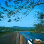
- A small park with a children’s play area maintained on both sides of the dam
- A pedestrian bridge connecting the two park sections in front of the dam
- A musical dancing fountain that operates between 6:00 AM and 8:00 PM on weekends and government holidays
This makes Vaigai a popular family destination for residents of Theni and Madurai, particularly during weekends when the fountain display draws crowds distinct from the farmers and water officials who engage with the dam on purely functional terms during the week.
Planning a Visit
A few practical points for anyone considering a trip:
- Location access: The dam sits near Periyakulam and Andipatti in Theni district, both well-connected by road from Madurai
- Best timing: Visit on weekends or public holidays if the musical fountain display is of interest, since it doesn’t run daily
- Combine with nearby attractions: Theni district is also home to Sothuparai Dam and Manjalar Dam, both within a short drive, along with natural attractions like Suruli Falls and Kumbakkarai Falls
- Seasonal considerations: Post-monsoon months from November to February typically offer the fullest reservoir views and most comfortable visiting weather
FAQs
Q. Is it true that Vaigai Dam receives water from another state’s river system?
Yes — a portion of the Vaigai’s water supply comes from Kerala’s Periyar River, diverted through a tunnel cut into the Western Ghats as part of the historic Mullaperiyar project, supplementing what the Vaigai’s own catchment can provide.
Q. Why is Vaigai Dam considered structurally unusual compared to other Indian dams?
It’s one of the few major dams not built between two mountains or hillsides, meaning it relies entirely on its own concrete gravity structure for stability rather than natural rock formations sharing the load.
Q. Can visitors see the musical fountain any day of the week?
No — the dancing fountain typically operates only on weekends and government holidays between 6:00 AM and 8:00 PM, so it’s worth planning a visit around those days if that’s the main draw.
Q. Which cities depend on Vaigai Dam for drinking water, not just irrigation?
Madurai city and Andipatti town both draw drinking water supply from the dam, in addition to its broader irrigation role across Theni, Dindigul, Sivagangai, and Ramanathapuram districts.