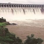
In July 2026, when the Vazhani reservoir’s water level lagged noticeably behind the previous year’s figures, Kerala’s Irrigation Department did something unusual — it diverted nearby forest streams into the reservoir just to keep storage from dropping further. That single episode says a lot about Vazhani Dam: a modest, 792-metre earth embankment tucked into the Western Ghats foothills of Thrissur district, quietly working overtime to keep thousands of hectares of farmland watered through every dry spell.
Vazhani Dam Quick Reference
| Parameter | Details |
| State | Kerala |
| District | Thrissur |
| Nearest town | Wadakkanchery (approx. 9–10 km) |
| Distance from Thrissur city | Approx. 22–23 km |
| River | Kechery River (also called Wadakkanchery river), a tributary of the Bharathapuzha |
| River origin | Machad Hills, Western Ghats |
| Dam type | Clay-core, earth-filled dam |
| Length | 792.48 metres |
| Catchment area | 20.72 sq. km |
| Reservoir surface area | 184.3 hectares |
| Full Reservoir Level (FRL) | 62.48 metres |
| Irrigation command area | Approx. 4,313 hectares |
| Taluks served | Thalappilly, Kunnamkulam, and Thrissur |
| Year completed | 1962 |
| Owner/operator | Government of Kerala, Irrigation Department |
| Surrounding protected area | Peechi-Vazhani Wildlife Sanctuary (established 1958) |
| Notable features | Hanging bridge, four-acre dam garden |
| Primary purpose | Irrigation and drinking water supply |
| Best time to visit | November to February |
The River That Shapes This Dam’s Character
Vazhani Dam sits across the Kechery River, better known locally as the Wadakkanchery river, which begins its journey in the Machad Hills along the edge of the Western Ghats before eventually merging into the Bharathapuzha, Kerala’s second-longest river. What makes this particular river-dam relationship distinctive is scale: the catchment feeding Vazhani’s reservoir spans just 20.72 sq. km, a fraction of what larger Kerala dams draw from.
This compact catchment explains a lot about how the dam behaves:
- Reservoir levels respond quickly to local rainfall patterns rather than large-scale upstream flows
- During weak monsoon years, storage can fall noticeably behind previous-year figures, as seen in mid-2026 when authorities had to actively supplement inflow
- The dam’s water security depends heavily on the health of the surrounding forest catchment, which is why its protection has long been tied to conservation efforts in the area
Built to End a Cycle of Monsoon Dependence
Vazhani Dam’s story starts with a problem familiar across much of Kerala’s midland belt: paddy fields and drinking water supplies that lived and died by how generous or stingy each year’s monsoon happened to be. Completed in 1962 by the state’s Irrigation Department, the dam was constructed specifically to break that dependency, giving Thalappilly and neighbouring taluks a stored water buffer that didn’t disappear the moment the rains stopped.
Unlike concrete or masonry-gravity dams built around the same period elsewhere in Kerala, Vazhani was built as a clay-core, earth-filled structure — a design choice suited to the terrain and materials available locally. This construction method places Vazhani among a small group of Kerala dams, including the far larger Banasura Sagar Dam in Wayanad, that rely on compacted earth and clay rather than poured concrete to hold back water.
A point worth noting for anyone researching the region’s water history:
- The project was conceived as part of a broader mid-20th-century push across Kerala to reduce agricultural vulnerability to erratic rainfall
- Its construction ran parallel to the development of protective forest cover around the catchment, recognising early on that the dam’s usefulness depended on the health of the hills feeding it
- The Peechi-Vazhani Wildlife Sanctuary, established in 1958, predates the dam’s completion by four years — a sequencing that shows conservation planning was built into the project from the outset, not added as an afterthought
Engineering Profile: Length, Design, and Water Levels
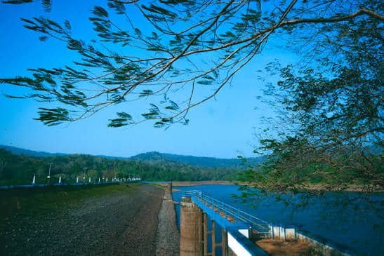
At 792.48 metres, Vazhani’s earthen embankment isn’t among Kerala’s longest dams, but it’s built with a specific kind of care that reflects its era. The embankment connects natural high ground on either side of the valley, with protective stone revetment facing the reservoir side to resist wave erosion, and turfed, grassed slopes on the downstream face — a combination that keeps the structure stable while giving it a notably tidy, landscaped appearance compared to purely utilitarian dam walls.
Key figures that define the dam’s engineering scale:
- Length: 792.48 metres
- Full Reservoir Level: 62.48 metres
- Catchment area: 20.72 sq. km
- Reservoir surface area: 184.3 hectares
- Spillway design: masonry construction fitted with steel shutters for controlled flood release
The spillway’s steel shutter system is particularly relevant during monsoon peaks, allowing the Irrigation Department to manage excess inflow without risking uncontrolled overtopping — a standard safety feature but one that matters given how quickly this compact catchment can respond to heavy, localised rainfall events.
Where the Water Actually Goes
Vazhani’s real economic weight shows up not at the dam site itself but across the farmland its canal network reaches. The irrigation command area covers approximately 4,313 hectares spread across three taluks — Thalappilly, Kunnamkulam, and Thrissur — supporting crops that have long defined this part of Kerala’s agricultural landscape.
What this irrigation network typically supports:
- Paddy cultivation across the command area, particularly during periods when monsoon timing would otherwise leave fields short of water
- Coconut cultivation, a mainstay crop across Thrissur’s midland belt
- Drinking water supplementation for communities within the command area, alongside the primary irrigation role
Because the command area draws from a relatively small reservoir, water release schedules tend to be managed carefully during low-rainfall years, with the department prioritising critical agricultural periods over discretionary use.
Life Around the Reservoir: Sanctuary, Garden, and the Hanging Bridge
Vazhani’s location inside the Peechi-Vazhani Wildlife Sanctuary gives it an ecological dimension most small irrigation dams never develop. The sanctuary, spread across roughly 125 sq. km including the areas around both Peechi and Vazhani dams, protects the forested catchment that ultimately keeps the reservoir fed, while also supporting wildlife including elephants that are occasionally spotted along the reservoir’s forest edges.
For visitors, the site offers more than just a view of the embankment:
- A four-acre garden maintained near the dam site, popular with families and day-trippers from Thrissur
- A hanging bridge that has become one of the more photographed features of the site
- Boating facilities on the reservoir, weather and water-level permitting
- Forest views and birdlife typical of Western Ghats foothill terrain, appealing to casual nature walkers rather than dedicated birding specialists
This mix of function and recreation is fairly typical of Kerala’s mid-century irrigation dams, many of which were later developed into modest tourist attractions once their primary agricultural role was well established.
Planning a Visit to Vazhani Dam
A few practical points for anyone considering a trip:
- Getting there: Vazhani is roughly 9–10 km from Wadakkanchery and about 22–23 km from Thrissur town, making it an easy half-day trip from the city
- Best season: November through February, when the reservoir typically holds a healthier water level following the monsoon and weather conditions are pleasant for outdoor visits
- Monsoon caution: During heavy rainfall periods, spillway releases can affect downstream river conditions, so it’s worth checking local advisories before planning a visit right after major rain events
- Combine with Peechi Dam: Given both sites fall within the same wildlife sanctuary complex, many visitors pair a Vazhani trip with a stop at the nearby Peechi Dam for a fuller day out
FAQs
Q. Is Vazhani Dam the same as Peechi Dam, since both fall under the same wildlife sanctuary?
No, they are two separate dams — Vazhani is built on the Kechery River while Peechi Dam is built on the Manali River — though both sit within the Peechi-Vazhani Wildlife Sanctuary and are often visited together.
Q. Why does Vazhani’s water level fluctuate so noticeably compared to larger Kerala dams?
Its catchment area is relatively small at just 20.72 sq. km, so reservoir levels respond quickly to local rainfall shortfalls or surpluses rather than being buffered by a large upstream drainage basin.
Q. Can visitors go boating on the Vazhani reservoir?
Boating facilities are available at the site, though availability can depend on current water levels and seasonal conditions, so it’s worth checking locally before planning a visit specifically for boating.
Q. What crops does the water from Vazhani Dam mainly support?
The irrigation network primarily supports paddy and coconut cultivation across roughly 4,313 hectares in Thalappilly, Kunnamkulam, and Thrissur taluks, alongside contributing to local drinking water supply.