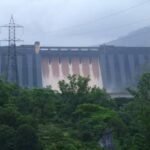
Once every twelve years, the hills surrounding Kundala Dam turn a striking shade of blue as the Neelakurinji flower blooms across the surrounding slopes — a botanical event so rare that entire tourist seasons in Munnar are planned around it. Add to that the sight of Kashmiri shikara boats gliding across a South Indian lake, cherry trees blossoming twice a year, and the distinction of being Asia’s first arch dam, and Kundala offers a combination of engineering history and natural spectacle that few other Indian dam sites can match.

Kundala Dam: Overview
| Parameter | Details |
| State | Kerala |
| District | Idukki |
| Location | Kundala, Mattupetty (Madupetty) panchayat |
| Distance from Munnar | Approx. 20–22 km, on the way to Top Station |
| Also known as | Setuparvatipuram Dam (Sethuparvathi Dam) |
| River | Muthirapuzha River, a tributary of the Periyar River |
| Dam type | Masonry gravity/arch dam — Asia’s first arch dam |
| Height (foundation) | 36.94 metres (121.2 ft); also cited as 46.93 metres (154 ft) |
| Length | 259.38 metres (851 ft) |
| Elevation | Approx. 1,700–1,759 metres above sea level |
| Year completed | 1947 |
| Part of | Pallivasal Hydroelectric Project — Kerala’s first hydroelectric scheme |
| Owner/operator | Kerala State Electricity Board |
| Spillway | 5 gates, Ogee type |
| Reservoir total capacity | 77.9 million cubic metres |
| Downstream flow | Releases via the Palar River to Mattupetty Dam, then onward by canal to the power house |
| Notable natural feature | Neelakurinji flowers, blooming once every 12 years |
| Popular activities | Kashmiri shikara and pedal boating, golf, photography |
| Best time to visit | September to May |
The Muthirapuzha River and Kundala’s Place in the Pallivasal Cascade
Kundala Dam sits across the Muthirapuzha River, a tributary of the Periyar, at an elevation of roughly 1,700 to 1,759 metres in Kerala’s Kannan Devan Hills. Its position within Kerala’s broader hydroelectric infrastructure is precise and deliberate: water stored at Kundala is released through the Palar River — itself a tributary of the Muthirapuzha — flowing downstream specifically to Mattupetty Dam, where it joins that reservoir’s own supply before eventually reaching a power house via canal.
A few points about this sequential arrangement:
- Kundala sits at the highest point in this particular chain, meaning its water makes the longest downhill journey before reaching the Pallivasal power generation system
- This cascade design — Kundala feeding Mattupetty, which in turn feeds the power house — reflects the same efficient, multi-stage water reuse philosophy found across several of Kerala’s high-altitude hydroelectric projects
- Water released from Kundala also reaches, further downstream, taluks including Udumbanchola, Devikulam, Kothamangalam, Muvattupuzha, Kunnathunad, Aluva, Kodungallur, and Paravur, extending its influence well beyond the immediate Munnar hills
History: Asia’s First Arch Dam
Kundala Dam was completed in 1947, constructed as part of the Pallivasal Hydroelectric Project — Kerala’s first hydroelectric scheme, whose power house had already begun operating in 1940. Kundala’s addition to this system came as project planners sought to expand the scheme’s water storage capacity to support growing power demand.
What sets Kundala apart historically is its engineering classification: it is widely considered Asia’s first arch dam, a genuinely significant milestone for Indian dam engineering in the years immediately following independence.
A few historical points worth noting:
- An arch dam design transfers water pressure sideways into the surrounding rock rather than relying purely on the dam’s own weight, a technique requiring specific geological conditions and considerably more sophisticated engineering than a straightforward gravity structure
- Kundala’s successful completion using this design, at a time when Indian civil engineering was still building its post-independence institutional capacity, represents a genuine technical achievement
- The dam’s alternate name, Setuparvatipuram (or Sethuparvathi) Dam, reflects local naming conventions tied to the surrounding landscape and community
Engineering Specifications
Kundala Dam is classified as a masonry structure combining gravity and arch design elements, with height figures varying somewhat across sources — 36.94 metres measured from the deepest foundation, or 46.93 metres by an alternate measurement standard commonly cited in tourism references. Its length is consistently recorded at 259.38 metres.
Core specifications:
- Height: 36.94 metres from deepest foundation (alternatively cited as 46.93 metres)
- Length: 259.38 metres (851 ft)
- Spillway: 5 gates, Ogee type, with a discharge capacity of approximately 184 cubic metres per second
- Reservoir total capacity: 77.9 million cubic metres
- Elevation at crest: approximately 1,757 metres
This high-altitude positioning, well over 1,700 metres above sea level, places Kundala among the highest-elevation major dam structures in South India, contributing directly to the site’s cool climate and scenic mountain backdrop.
A Botanical Rarity: The Neelakurinji Bloom
Perhaps the single most distinctive feature of the Kundala area has nothing to do with the dam’s engineering at all. The surrounding hills are home to the Neelakurinji (Strobilanthes kunthiana), a shrub that blooms only once every twelve years, transforming the landscape into a striking carpet of blue-purple flowers for a brief window before returning to its usual green state for another twelve-year cycle.
This rare botanical event has genuine cultural and tourism significance:
- The Neelakurinji’s twelve-year bloom cycle is one of the most unusual flowering patterns found anywhere in the world, drawing significant domestic and international visitor interest during bloom years
- Munnar’s broader tourism calendar is often shaped around anticipated bloom years, with the most recent major bloom occurring in 2018 and the next expected around 2030
- Even outside bloom years, the surrounding shola grasslands and hills retain a genuine ecological significance tied to this unique plant species, native specifically to this stretch of the Western Ghats
Kashmiri Boats in the Western Ghats: What Makes Kundala Different to Visit
Beyond its engineering and botanical significance, Kundala has developed a genuinely distinctive recreational identity, most notably through an unexpected import from thousands of kilometres away.
Key visitor draws include:
- Kashmiri shikara boat rides, an unusual sight on a South Indian lake, offering a leisurely, romantic boating experience often favoured by honeymooning couples visiting Munnar
- Pedal boats, offering a more active alternative for visitors wanting to explore the lake themselves
- Cherry trees surrounding the dam, which bloom twice a year, adding seasonal colour to the site independent of the much rarer Neelakurinji cycle
- A nearby golf course, adding an additional recreational dimension uncommon at most Indian dam sites
- Photography opportunities, particularly recommended in the early morning when sunlight falls across the lake at its most striking angle
This combination of rare botanical spectacle, imported boating culture, and genuinely scenic high-altitude setting has made Kundala one of the more consistently recommended stops on any Munnar itinerary, distinct from the more purely engineering-focused character of many other Indian dam destinations.
Planning a Visit to Kundala Dam
For anyone considering a trip:
- Getting there: The dam sits roughly 20–22 km from Munnar town, along the road toward Top Station
- Best season: September through May offers the most comfortable weather at this high elevation, with early morning visits recommended for photography
- Combine with nearby attractions: Given its proximity to Mattupetty Dam and Top Station, Kundala fits naturally into a broader single-day Munnar itinerary covering multiple hill-country attractions
- Bloom-year planning: Visitors specifically hoping to see the Neelakurinji in bloom should check current botanical reports, since the flowering occurs only once every twelve years and is not a guaranteed annual sight
FAQs
Q1. Is Kundala Dam really Asia’s first arch dam, and what does that distinction actually mean?
Yes — Kundala is widely credited as Asia’s first arch dam, a design that transfers water pressure sideways into surrounding rock rather than relying solely on the dam’s own weight, representing a genuinely advanced engineering achievement for India in the years following independence.
Q2. When is the next chance to see the Neelakurinji flowers in bloom near Kundala?
The Neelakurinji blooms only once every twelve years, with the most recent major bloom occurring in 2018, meaning the next expected bloom would fall around 2030 — visitors hoping to see this specific spectacle should plan well in advance and confirm current botanical timing before travelling.
Q3. Why are there Kashmiri-style shikara boats on a lake in Kerala?
The shikara boats were introduced specifically as a recreational offering at Kundala Lake, giving visitors an unusual, romantic boating experience modelled on the traditional Kashmiri boats typically associated with Dal Lake, rather than reflecting any historical connection between the two regions.
Q4. How is Kundala Dam connected to Mattupetty Dam, and should I visit both on the same trip?
Water released from Kundala flows via the Palar River directly to Mattupetty Dam downstream, and since the two sites sit close to each other along the same Munnar-to-Top-Station route, most visitors combine both dams into a single day’s sightseeing.