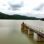
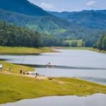
Scientists around the world studying how dams can trigger earthquakes almost always start with the same case study: Koyna. When a magnitude 6.3 earthquake struck this quiet corner of Maharashtra’s Western Ghats in December 1967, killing over 175 people in a region previously considered seismically stable, it became the global textbook example of reservoir-induced seismicity — and more than six decades later, researchers are still drilling deep into the Koyna seismic zone to understand exactly why filling a reservoir can wake up ancient geological faults.
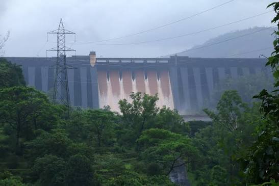
Koyna Dam: Overview
| Parameter | Details |
| State | Maharashtra |
| District | Satara |
| Location | Koyna Nagar |
| Distance from Mumbai | Approx. 200 km south |
| River | Koyna River, a tributary of the Krishna River |
| River source | Mahabaleshwar area, Western Ghats |
| Dam type | Rubble concrete gravity dam |
| Height | 103 metres |
| Construction period | Approx. 1954 to 1962–63 |
| Reservoir | Shivsagar Lake (Shivaji Sagar Lake) |
| Installed power capacity | Approx. 1,960 MW across four project stages |
| Unique engineering feature | Inter-basin diversion — Krishna basin water redirected via the Vashishti River into the Arabian Sea |
| Notable event | 1967 Koynanagar earthquake, magnitude approx. 6.3 |
| Global scientific significance | World’s most extensively studied case of reservoir-induced seismicity |
| Adjacent protected area | Koyna Wildlife Sanctuary, part of the Sahyadri Tiger Reserve and Western Ghats UNESCO World Heritage Site |
| Nearby heritage site | Vasota Fort, accessible by boat and trekking |
| Best time to visit | October to February |
The Koyna River and an Unusual East-to-West Water Diversion
The Koyna River rises near Mahabaleshwar in the Western Ghats and would naturally flow, like most rivers in this part of Maharashtra, as part of the eastward-draining Krishna basin toward the Bay of Bengal. Koyna Dam’s engineering deliberately overrides this natural course through one of the more unusual design features found at any major Indian hydroelectric project.
Rather than releasing water to continue its natural eastward journey, the project diverts water from the Krishna basin through tunnels toward the Vashishti River, which flows west and empties directly into the Arabian Sea. A few points about why this matters:
- This inter-basin diversion takes advantage of the dramatic elevation drop between the Western Ghats plateau and the coastal Konkan plain, generating substantially more hydroelectric power than would be possible if the water simply continued its natural eastward course
- The approach reflects sophisticated mid-20th-century Indian hydroelectric engineering, recognising that redirecting water across a natural basin divide could unlock considerably more energy potential from the same volume of water
- This diversion is central to why Koyna ranks among India’s largest completed hydroelectric facilities by installed capacity, despite the dam itself not being exceptionally tall by Indian standards
Building One of India’s Largest Hydroelectric Projects
Construction on Koyna Dam took place across the mid-to-late 1950s and into the early 1960s, with the dam completed and its reservoir beginning to fill by 1962–63. Built using rubble concrete — large local stone aggregate bound with cement — the project made efficient use of regionally available materials while ensuring the structural durability needed for a dam of this scale.
A few historical points worth noting:
- This construction technique allowed engineers to build a substantial gravity structure while managing costs and material logistics suited to the relatively remote Western Ghats location
- The project was developed in multiple stages over subsequent decades, expanding its power generation capacity well beyond the original design as demand for Maharashtra’s electricity grid grew
- Today, Koyna’s combined installed capacity of approximately 1,960 MW across four stages makes it one of India’s largest hydroelectric facilities, a scale achieved specifically through the project’s innovative inter-basin diversion design
The Night the Ground Moved: The 1967 Koynanagar Earthquake
On 11 December 1967, at approximately 4:21 am, a powerful earthquake struck the Koynanagar region, with a magnitude most consistently recorded at around 6.3 (some sources cite figures ranging up to 6.7). The epicentre sat very close to the dam itself, in a region that geologists had previously believed to be seismically stable, part of the ancient and supposedly quiet Deccan Traps formation.
The human toll was severe:
- Approximately 177 to over 200 people were killed, with more than 2,200 injured
- More than 80% of houses in Koynanagar township sustained damage, leaving over 5,000 people homeless
- The earthquake caused a ground fissure 10 to 15 cm wide, spreading across a remarkable 25 km stretch
Remarkably, the dam itself largely survived. It sustained horizontal cracks on its upstream face, with the widest reaching approximately 1.5 cm, but suffered no major structural failure. These cracks were repaired relatively quickly, and the dam has continued operating safely in the decades since — though senior project officials at the time notably disputed the theory that the reservoir itself had caused the earthquake, a position that stood in contrast to the growing scientific consensus.
Six Decades of Ongoing Scientific Study
What makes Koyna genuinely unique in global dam engineering isn’t just the 1967 earthquake itself, but everything that has followed. The Koyna-Warna region has continued experiencing seismic activity for more than six decades since the reservoir was first impounded in 1962, making it the world’s longest-running and most extensively documented case of reservoir-triggered seismicity.
Key findings from ongoing research include:
- Seismic activity in the region correlates with reservoir water level fluctuations — the rate of water level increase, the maximum level reached, and how long high levels are sustained all appear to influence tremor frequency
- A burst of seismic activity between September 1967 and January 1968 followed record water levels, including a magnitude 5.5 earthquake in September 1967 and the damaging magnitude 6.0 event in December that year
- When water levels were kept lower over the following five years, no significant earthquakes occurred until 1973, when the reservoir was filled to maximum capacity again and a magnitude 5.1 earthquake followed
- Scientists have drilled a 3 km deep research borehole directly into the Koyna seismic zone, allowing rare in-situ study of stress conditions in the crystalline basement rock believed to drive this triggered seismicity
- Recent analysis covering 2005 to 2022 has found an increasingly clear statistical correlation between water level changes and earthquake occurrence in the region
This sustained research programme has made Koyna genuinely foundational to how dam engineers worldwide now think about reservoir safety, monitoring, and the risks of rapid impoundment in previously “stable” geological zones.
Engineering Specifications and Power Generation
Koyna Dam is a rubble concrete gravity structure standing 103 metres tall, positioned to create the Shivsagar Lake reservoir behind it.
Core specifications:
- Height: 103 metres
- Construction material: rubble concrete (large stone aggregate bound with cement)
- Reservoir: Shivsagar Lake (also called Shivaji Sagar Lake)
- Installed power capacity: approximately 1,960 MW, developed across four project stages
Following the 1967 earthquake, an emergency action plan was implemented specifically for the dam, outlining flood warning procedures, evacuation protocols, and rapid response measures for any future structural alerts — a direct legacy of lessons learned from that formative event, and a framework that continues informing the dam’s operation today.
A Reservoir Inside a Tiger Reserve
Beyond its engineering and seismological significance, Koyna Dam sits within a landscape of genuine ecological importance. The backwaters of Shivsagar Lake are flanked by the Koyna Wildlife Sanctuary, which forms a core part of the Sahyadri Tiger Reserve and sits within the broader Western Ghats UNESCO World Heritage Site.
For visitors, this combination offers:
- Wildlife viewing opportunities within one of Maharashtra’s significant protected forest areas
- Boat access across the reservoir to Vasota Fort, an ancient hilltop fortification reachable through trekking routes, offering panoramic views across the surrounding Western Ghats terrain
- A genuinely rare pairing of major hydroelectric infrastructure with a UNESCO-recognised biodiversity hotspot in the same immediate landscape
Planning a Visit to Koyna Dam
For anyone considering a trip:
- Getting there: The dam sits at Koyna Nagar in Satara district, roughly 200 km south of Mumbai, accessible by road
- Best season: October through February offers the most comfortable weather and typically a well-filled reservoir following the monsoon
- Combine with Vasota Fort: A boat trip across Shivsagar Lake followed by a trek to Vasota Fort is a popular way to experience both the reservoir and the surrounding wildlife sanctuary
- Respect security and safety protocols: As a critical, seismically monitored piece of national infrastructure, certain areas around the dam may have restricted access, so visitors should expect to view the structure primarily from designated public areas
FAQs
Q1. Is it still safe to visit Koyna Dam given its history of triggering earthquakes?
Yes — the dam itself survived the 1967 earthquake with only minor, quickly repaired cracks, and it has operated safely for decades since under an emergency action plan and continuous seismic monitoring, making it a normally accessible tourist destination today.
Q2. Why does filling a reservoir with water actually cause earthquakes?
Researchers believe the immense weight of stored water, combined with increased water pressure seeping into pre-existing geological faults in the underlying rock, can reactivate ancient fractures that would otherwise have remained dormant — a phenomenon called reservoir-induced or reservoir-triggered seismicity, of which Koyna remains the world’s most studied example.
Q3. What makes Koyna Dam’s power generation design different from most other Indian hydroelectric dams?
Its water is deliberately diverted from the Krishna river basin, where it would naturally flow east, into the west-flowing Vashishti River instead, taking advantage of the steep elevation drop from the Western Ghats plateau to the coastal plain to generate significantly more power than the natural river course would allow.
Q4. Can visitors combine a trip to Koyna Dam with wildlife viewing or trekking?
Yes — the reservoir sits within the Koyna Wildlife Sanctuary, part of the Sahyadri Tiger Reserve, and many visitors combine a boat trip across the lake with a trek to the nearby Vasota Fort for panoramic Western Ghats views.