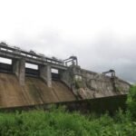
Nearly 1,900 years before India had an independent government, a Chola king ordered a stone barrier built across the Kaveri River using the labour of prisoners captured in his Ceylon campaigns. That structure, Kallanai — better known as the Grand Anicut — is still functioning exactly as designed today, making it one of the oldest water-regulation structures anywhere in the world still actively diverting water for irrigation.

Kallanai Dam: Overview
| Parameter | Details |
| State | Tamil Nadu |
| District | Thanjavur (bordering Tiruchirappalli district) |
| Distance from Tiruchirappalli | Approx. 14–15 km |
| Distance from Thanjavur | Approx. 45 km |
| Also known as | Grand Anicut (“Kallanai” literally means “stone dam”) |
| River | Kaveri (Cauvery) River |
| Built by | Karikala Chola (Karikalan), Chola dynasty |
| Construction period | c. 100–150 CE (2nd century AD) |
| Dam type | Barrage / diversion anicut, built from unhewn stone |
| Original height | Approx. 4.5 metres (later raised) |
| Length | 329 metres (1,079 ft) |
| Base width | 20 metres (66 ft) |
| British remodelling | 1804, by Captain Caldwell |
| Height increase (1804) | Raised by 69 cm (27 in) |
| Irrigated area | Reportedly up to 400,000 hectares across the Cauvery Delta |
| Function | Diversion weir — redirects river flow rather than storing water |
| Status | Considered one of the oldest functioning water-regulation structures in the world |
| Visiting hours | Typically 7 AM to 8 PM daily |
| Best time to visit | October to February |
The Kaveri Delta: Why This Exact Spot Was Chosen
Kallanai sits at a strategically vital point on the Kaveri River, positioned precisely where engineers needed to intervene to protect the fertile Thanjavur delta region — often described as Tamil Nadu’s rice bowl — from both flooding and water scarcity. Downstream of this point, the Kaveri splits into distributaries, including the Kollidam, and without careful regulation, the majority of the river’s flow would simply bypass the delta’s agricultural land altogether.
A few points about this location’s significance:
- The site sits within the broader Cauvery basin system that also includes Mettur Dam further upstream, part of the same historic river whose water-sharing has shaped centuries of regional agricultural development
- The delta’s fertility depended entirely on reliable irrigation water reaching farmland rather than draining away through natural distributaries during the dry season
- This positioning made Kallanai essential infrastructure for an agricultural economy that has depended on it, in some form, for nearly two millennia
Built by an Empire-Building King, Nearly Two Millennia Ago
Kallanai’s construction is attributed to Karikala Chola, a king whose military campaigns reportedly extended Chola territory into what is now Sri Lanka. According to historical accounts, the labour for constructing the dam came from prisoners of war captured during these campaigns — a detail reflecting the era’s typical practices for large public works projects.
A few historical points worth noting:
- Construction is generally dated to around 100–150 CE, placing Kallanai among the oldest documented large-scale water engineering projects anywhere in the world
- The original structure was built as a check dam using unhewn stones laid directly against the river’s flow, without the mortared or cut-stone construction techniques used in some other ancient dam projects like Kodiveri Anicut in Erode district
- Karikala’s broader historical reputation as a territory-expanding, infrastructure-building king places Kallanai within a pattern of ambitious Chola-era public works projects
How an Anicut Actually Works
Understanding Kallanai requires recognising a key distinction from most modern dams: it was never designed to store large volumes of water behind it. Instead, it functions as a diversion weir, or anicut, redirecting river flow into irrigation channels rather than impounding a reservoir.
The original engineering logic worked as follows:
- Under normal conditions, the anicut limited how much Kaveri water flowed into the Kollidam distributary, preserving more water for the delta’s irrigation canals
- During monsoon floods, excess water was allowed to pass over the structure into the Kollidam, protecting the delta from flood damage while still capturing what was needed for agriculture during the rest of the year
- This dual function — restricting flow during normal conditions while permitting overflow during floods — made Kallanai a remarkably sophisticated piece of engineering for its era, achieving flood protection and irrigation security simultaneously without the complexity of a large storage reservoir
The British Rediscovery and 19th-Century Remodelling
By the early 1800s, after well over a thousand years of continuous operation, Kallanai’s effectiveness had degraded to the point where a disproportionate share of the Kaveri’s water was flowing into the Kollidam rather than reaching delta irrigation canals. In 1804, the British colonial administration appointed Captain Caldwell, a military engineer, to study the Kaveri and improve irrigation outcomes for the delta region.
Caldwell’s intervention was relatively modest but effective:
- He identified that too much water was escaping into the Kollidam, leaving insufficient volume for irrigation
- His solution involved raising the dam’s stones by 69 cm (27 inches), increasing the structure’s capacity to divert water toward the delta canals rather than letting it pass downstream
- This remodelling didn’t replace the ancient Chola-era structure but built directly upon it, preserving the original engineering while addressing centuries of gradual performance decline
This colonial-era intervention is itself now over two centuries old, meaning Kallanai’s current form represents layers of engineering intervention spanning nearly 1,900 years of continuous use and periodic improvement.
Engineering Specifications
Kallanai stands as a barrage-type structure built from unhewn stone, with a base width of 20 metres and stretching 329 metres across the Kaveri. Its original height of approximately 4.5 metres was increased by 69 cm during the 1804 British remodelling.
Core specifications:
- Length: 329 metres (1,079 ft)
- Base width: 20 metres (66 ft)
- Original height: approximately 4.5 metres, later raised
- Construction material: unhewn stone, laid as a check dam against the river’s flow
- Dam type: barrage/diversion weir, not a storage dam
This scale, while modest compared to India’s large modern gravity and earthfill dams, reflects the structure’s fundamentally different purpose — regulating flow direction rather than impounding a massive reservoir.
What Kallanai Still Delivers Today
Remarkably, Kallanai continues performing essentially the same function today that it was built for nearly two millennia ago:
- Irrigation: Diverting Kaveri water into canal networks that reportedly reach as much as 400,000 hectares of farmland across the Cauvery Delta
- Flood management: Continuing to allow excess floodwater to pass into the Kollidam during peak monsoon periods, protecting delta farmland from flood damage
- Agricultural foundation: Remaining central to the productivity of Tamil Nadu’s rice bowl region, an agricultural identity the delta has held since long before modern statehood
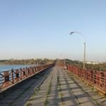
Today, the area around Kallanai has also been developed with walkways, viewpoints, and small parks, transforming what remains primarily functional ancient infrastructure into a genuine heritage tourism destination for visitors exploring Tiruchirappalli.
Planning a Visit to Kallanai Dam
For anyone considering a trip:
- Getting there: The dam sits roughly 14–15 km from Tiruchirappalli and about 45 km from Thanjavur, making it accessible from either city
- Visiting hours: Typically open from 7 AM to 8 PM daily
- Best season: October through February offers comfortable weather, while visiting during or shortly after the monsoon shows the structure’s flood-management function in action
- What to see: Beyond the ancient stone structure itself, the surrounding walkways and viewpoints offer good vantage points for appreciating the scale and setting of this nearly 2,000-year-old engineering achievement
FAQs
Q1. Is Kallanai Dam really the oldest dam in the world still in use?
It’s widely regarded as one of the oldest functioning water-regulation structures in the world, with construction dating to around the 2nd century CE, though exact global rankings can vary depending on how different ancient structures are classified and compared.
Q2. Why is Kallanai called an “anicut” rather than just a dam?
An anicut is specifically a diversion weir designed to redirect river flow into irrigation channels rather than storing large volumes of water behind it, which is precisely how Kallanai has always functioned, distinguishing it from modern storage dams.
Q3. How did the British changes in 1804 affect the original ancient structure?
Captain Caldwell’s modification simply raised the existing stone structure by 69 cm to improve water diversion toward irrigation canals, building upon rather than replacing the original Chola-era engineering that had already been functioning for over a thousand years.
Q4. Is Kallanai Dam connected to the broader Cauvery water-sharing issues between Tamil Nadu and Karnataka?
While Kallanai sits within the same Kaveri river system affected by the broader interstate water dispute, it functions primarily as a local delta irrigation structure rather than being directly central to the interstate allocation disputes, which more heavily involve upstream structures like Mettur Dam.