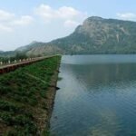
Long before Poomala Dam existed, this hill was simply forest — dense enough that its very name comes from the Poovam tree that once grew here in abundance, or perhaps from the poovan pazham banana variety local farmers cultivated. Christian settlers from central Travancore eventually cleared and occupied this land, transforming it into one of Thrissur’s quieter hill stations, and it was only decades later that a modest irrigation dam turned Poomala into an officially designated tourist destination.
Poomala Dam: Overview
| Parameter | Details |
| State | Kerala |
| District | Thrissur |
| Location | Poomala, Mulankunnathukavu Panchayath, Puzhakkal block |
| Distance from Thrissur town | Approx. 11 km |
| Water source | Poomalathadu, a tributary stream of the Puzhakkal River |
| Wider river system | Puzhakkal River (29 km, draining into Thrissur Kole Wetlands) |
| Dam type | Earthen (constructed with mud and stone) |
| Original structure | A division weir built in 1939 |
| Reservoir commissioned | 1968 |
| Elevation | 94.50 metres above mean sea level |
| Managed by | Kerala Minor Irrigation Department |
| Nearby related structure | Pathazhakundu Dam (irrigation only) |
| Tourism development | DTPC beautification project, Rs 50 lakh, launched 2008 |
| Officially designated tourist centre | 21 March 2010, by Home Minister of State Kodiyeri Balakrishnan |
| Amenities | Boating, horse riding, 600 m walkway, community hall (300 capacity), cafeteria |
| Nearby attraction | Muniarra cave |
| Best time to visit | October to February |
The Puzhakkal River System and a Modest Valley Stream
Poomala Dam draws its water from the Poomalathadu, one of the main tributary streams feeding the Puzhakkal River — a 29 km westward-flowing river that originates in the Killannoor Hills before eventually draining into the Thrissur Kole Wetlands, one of Kerala’s most agriculturally and ecologically significant wetland systems.
A few points about this connection:
- Being a tributary stream rather than a major named river in its own right, the Poomalathadu’s scale reflects Poomala Dam’s status as a genuinely modest, locally significant water structure rather than a major regional reservoir
- The Puzhakkal River’s other main tributaries include the Parathodu, Naduthodu, and Kattachirathodu, together forming a network of smaller streams that collectively support the Thrissur Kole Wetlands’ distinctive below-sea-level rice cultivation system downstream
- This positioning means Poomala Dam, while modest in scale, forms part of a broader hydrological system with genuine significance to Thrissur’s traditional agricultural landscape
From an Ancient Forest to a Christian Settler Hill Station
Poomala’s history predates the dam by considerably more than the structure’s own 1939-to-1968 construction timeline. The area was largely forest until Christian settlers from central Travancore arrived and occupied the land, gradually transforming it into cultivated and inhabited territory.
A few points about this settlement history:
- The village’s name itself carries two competing local explanations — either derived from the Poovam tree (also known as Ceylon oak or gum-lac tree), which was once plentiful in the area, or from ‘poovan pazham,’ a banana variety grown extensively here
- Several smaller villages in the surrounding area — Parambayi, Poomala, and Chottupara — are now collectively grouped together and referred to simply as Poomala
- This settlement pattern, driven by migration from central Travancore rather than purely local population growth, reflects a broader historical movement of Christian farming communities into Kerala’s forested hill regions during the 19th and 20th centuries
A Weir in 1939, a Reservoir in 1968: Building Poomala Dam
Poomala Dam’s development unfolded in two distinct phases, separated by nearly three decades. The first structure at this site was a division weir, constructed in the Poomala Valley in 1939 — a relatively modest water-diversion structure built well before India’s independence. It wasn’t until 1968 that the fuller Poomala reservoir was commissioned, representing a significant expansion of the original water-management infrastructure at this location.
A few historical points worth noting:
- This phased development — a modest 1939 weir followed by a more substantial 1968 reservoir — reflects a common pattern for smaller Kerala irrigation projects, where initial colonial-era infrastructure was later expanded under post-independence state government planning
- The dam has been managed throughout by Kerala’s Minor Irrigation Department, reflecting its classification as a smaller, locally significant project rather than a major state or interstate water infrastructure undertaking
- Its construction using mud and stone reflects straightforward, cost-effective engineering suited to a modest valley stream rather than the more elaborate masonry or concrete gravity designs used at Kerala’s larger dams
What’s Known About the Engineering
Precise height and length specifications for Poomala Dam are not consistently documented in accessible public engineering records, including in official state water resources listings, which show these particular fields blank for this specific structure. This reflects the dam’s status as a genuinely minor, locally focused irrigation project rather than one with extensive published technical documentation.
What is clearly established:
- The dam sits at an elevation of 94.50 metres above mean sea level
- It was built using mud and stone construction, consistent with a modest earthen structure
- For readers specifically seeking precise height and length figures, Kerala’s Minor Irrigation Department would be the most reliable direct source, given the gaps in general public documentation for this particular site
From Irrigation Project to Official Tourist Centre
Poomala Dam’s original purpose was straightforwardly agricultural — irrigation for the surrounding valley. Its transformation into a recognised tourist destination came much later and reflects a deliberate government development effort rather than organic, gradual popularity growth.
Key milestones in this transformation:
- In 2008, Thrissur’s District Tourism Promotion Council (DTPC) launched a Rs 50 lakh project specifically aimed at beautifying the environs around the dam
- On 21 March 2010, Poomala Dam was officially designated a tourist centre by Kodiyeri Balakrishnan, then Home Minister of State
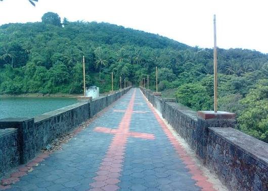
- This designation brought with it a range of new visitor amenities, including boating on the reservoir, horse riding, a 600-metre walkway, a community hall accommodating up to 300 people, a cafeteria, and basic sanitation facilities
This kind of deliberate, government-funded transformation from purely functional irrigation infrastructure into a developed tourist site reflects a pattern seen at several smaller Kerala dams, where local tourism boards have recognised the recreational potential of otherwise modest agricultural water bodies.
Nearby: Pathazhakundu Dam and Muniarra Cave
Poomala Dam doesn’t stand entirely alone in this landscape. Just to its north lies Pathazhakundu Dam, a related structure that remains oriented purely toward irrigation, without the tourism development Poomala itself has received. This makes for an interesting local contrast between two nearby dams that followed very different development paths despite their geographic proximity.
Beyond the dam itself, Poomala’s status as a popular hill station destination is reinforced by Muniarra, a cave where a saint is said to have once meditated — a site of genuine local spiritual and historical interest that adds a further layer to a visit beyond the reservoir and its recreational facilities.
Planning a Visit to Poomala Dam
For anyone considering a trip:
- Getting there: The dam sits roughly 11 km from Thrissur town, within the Mulankunnathukavu Panchayath area
- Best season: October through February offers the most comfortable weather for the walkway, boating, and horse riding activities
- Combine with Muniarra cave: Given its proximity and local historical significance, pairing a Poomala Dam visit with the nearby cave adds meaningful context to the trip
- What to expect: A modest, government-developed tourist site rather than a large-scale destination, offering boating, horse riding, and walking facilities suited to a relaxed half-day visit
FAQs
Q1. Why can’t I find the exact height and length of Poomala Dam in official records?
As a smaller, locally managed irrigation structure under Kerala’s Minor Irrigation Department rather than a major state or interstate project, Poomala Dam hasn’t received the same level of detailed public engineering documentation as Kerala’s larger dams, so this information is best confirmed directly through the Minor Irrigation Department.
Q2. Is Poomala Dam connected to a named river, or just a small local stream?
It draws water from the Poomalathadu, a tributary stream that feeds into the larger 29 km Puzhakkal River, which eventually drains into the significant Thrissur Kole Wetlands, giving the dam a genuine, if modest, place within a broader named river system.
Q3. What’s the difference between Poomala Dam and the nearby Pathazhakundu Dam?
While both sit close to each other, Poomala Dam has been developed as an official tourist centre with boating, horse riding, and walkway facilities, whereas Pathazhakundu Dam remains oriented purely toward irrigation without similar tourism infrastructure.
Q4. Is Poomala worth visiting beyond just the dam itself?
Yes — given the area’s history as a hill station settled by Christian migrants from central Travancore, along with the nearby Muniarra cave associated with a meditating saint, Poomala offers genuine cultural and historical interest alongside the dam’s recreational facilities.