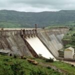
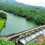
Tungabhadra Dam near Hospet stands as one of India’s most remarkable engineering achievements from the early years of independence, a structure built almost entirely from mud and limestone at a time when the country was still finding its industrial footing. Also known as Pampa Sagar, this dam has irrigated farmland, generated power, and controlled floods across Karnataka and Andhra Pradesh for over seven decades, and it remains one of only two dams in India constructed using this unusual surki mortar technique.
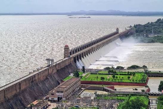
Quick Facts: Tungabhadra Dam
| Detail | Information |
| Also Known As | Pampa Sagar |
| River | Tungabhadra River (tributary of the Krishna) |
| Location | Hosapete (Hospet), Vijayanagara district, Karnataka |
| Construction Period | 1949–1953 |
| Height | 49.5 metres (162 feet) |
| Length | 2,449 metres (8,035 feet) |
| Reservoir Capacity | 3.73 cubic km (132 TMC) total |
| Installed Power Capacity | 127 MW |
The River Behind the Dam
The Tungabhadra River forms from the confluence of two separate streams, the Tunga and the Bhadra, both originating in the Western Ghats. The Tunga runs roughly 147 kilometres before merging with the Bhadra, which itself flows about 178 kilometres, and their combined waters travel further as the Tungabhadra proper near Shimoga in Karnataka.
- The river covers roughly 531 kilometres before joining the Krishna River at Sangameshwaram in Andhra Pradesh.
- It flows 382 kilometres within Karnataka, forms a 58-kilometre boundary between Karnataka and Andhra Pradesh, and continues for another 91 kilometres inside Andhra Pradesh.
- As the largest tributary of the Krishna, the Tungabhadra plays a significant role in the broader river system supporting agriculture across both states.
- The river is influenced chiefly by the southwest monsoon, which determines much of its seasonal flow pattern and, by extension, the dam’s storage levels each year.
A Joint Project Born From Post-Independence Ambition
Construction on the Tungabhadra Dam began in 1949, while India was still adjusting to its newly independent status, and it was initially a joint undertaking between the erstwhile Kingdom of Hyderabad and the Madras Presidency. As state boundaries reorganized in the years that followed, responsibility for the dam eventually passed to Karnataka and Andhra Pradesh, who jointly completed the project in 1953.
The dam’s purpose extended well beyond simple water storage. Planners envisioned it as a way to combat regional food shortages, power rural industries, and stabilize a river that had historically been unpredictable. This ambition placed the Tungabhadra project among the more transformative infrastructure efforts of newly independent India, reflecting a broader push to modernize the region’s economy through better water and power management.
Engineering That Predates Modern Concrete Construction
What makes the Tungabhadra Dam genuinely unusual among Indian dams is its construction material. Rather than relying on cement, engineers built the structure using surki mortar, a combination of mud and limestone that was commonly used at the time.
- The dam stands as India’s largest stone masonry dam, and it shares the distinction of being built with this mud-and-limestone technique with only one other structure in the country, the Mullaperiyar Dam in Kerala.
- Its total length runs 2,449 metres, with a height of 49.5 metres measured from the deepest foundation point.
- The dam features 33 crest gates controlling water flow, along with a spillway capable of handling 650,000 cusecs during peak flood conditions.
- Left of the main structure, two additional barrages were built — one earthen and another using stone and surkhi — supporting the overall water management system.
Where Exactly the Dam Sits
The Tungabhadra Dam sits near Hospet (officially Hosapete) in Karnataka’s Vijayanagara district, at the confluence area extending toward Koppal district, with the Munirabad locality often cited as its precise site.
- The dam lies roughly 20 kilometres southwest of Hampi, the UNESCO World Heritage town famous for its Vijayanagara Empire ruins.
- Hospet Junction Railway Station, the nearest rail connection, sits about 5 kilometres from the dam and connects to major cities including Bengaluru, Hyderabad, and Goa.
- By road, the dam is roughly 330 kilometres from Bengaluru, 380 kilometres from Hyderabad, and 60 kilometres from Bellary.
- KSRTC buses, private operators, and taxis all run regularly to Hospet, making the dam reasonably accessible for both domestic tourists and those combining a visit with the broader Hampi heritage circuit.
Serving Irrigation, Power, and Flood Control
The dam’s multipurpose design reflects the varied needs it was built to address across the two states it serves.
- Irrigation remains its primary function, supplying water to agricultural land across both Karnataka and Andhra Pradesh through an extensive canal network.
- A power station near the toe of the dam and along canal drops generates electricity with an installed capacity of 127 MW, contributing to the region’s energy supply.
- Flood control forms another significant purpose, helping manage the Tungabhadra River’s historically unpredictable monsoon-driven flow.
- The reservoir’s catchment area spans roughly 28,180 square kilometres, with a surface area of about 350 square kilometres when full.
Recent Developments Worth Knowing
The dam has faced notable infrastructure challenges in recent years that drew significant national attention. One of its 33 crest gates, Gate No. 19, was washed away in an incident that raised serious concerns about the ageing structure’s safety and operational integrity. Following extensive repair work, all 33 crest gates have since been replaced, restoring the dam to full operational capacity.
This incident underscored just how critical continued maintenance remains for infrastructure built over seven decades ago, even one as historically significant and structurally unique as the Tungabhadra Dam.
Visiting the Dam and Nearby Attractions
Beyond its engineering and agricultural significance, the Tungabhadra Dam has become a genuine tourist destination, known for its scenic surroundings and connection to the broader Hampi heritage region.
- The dam area includes well-maintained gardens, and sunset views here are particularly popular among visitors, with the dam’s lights adding to the atmosphere as evening falls.
- Anegundi, located about 28 kilometres from the dam, is often identified with the mythological kingdom of Kishkindha from the Ramayana, offering rich folklore, temples, and striking landscapes for visitors extending their trip.
- The surrounding area is also known for manganese mining activity and the Kumaraswamy Temple, adding further points of interest nearby.
- October through February is generally considered the best time to visit, when calmer weather and cooler temperatures make outdoor exploration and sightseeing considerably more comfortable.
Frequently Asked Questions
Q1. Which river does the Tungabhadra Dam impound, and which state is it located in?
The dam is built across the Tungabhadra River, a major tributary of the Krishna River, and it is located near Hospet in Karnataka’s Vijayanagara district, close to the Koppal district boundary.
Q2. Why is the Tungabhadra Dam considered unique among Indian dams?
It is India’s largest stone masonry dam and one of only two dams in the country built using a mud-and-limestone surki mortar technique instead of modern cement, the other being the Mullaperiyar Dam in Kerala.
Q3. How far is the Tungabhadra Dam from Hampi, and can I visit both in one trip?
The dam sits roughly 20 kilometres southwest of Hampi, making it easy to combine both destinations in a single trip, particularly since Hospet serves as a common base town for exploring the wider Hampi heritage region.