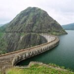
Ask most Indians to name the country’s biggest dam, and Bhakra or Sardar Sarovar usually comes to mind first. But by the measure that actually matters most for water security — total reservoir volume — neither holds the title. That distinction belongs to Indira Sagar Dam in Khandwa district, whose reservoir holds more water than any other in India, submerging an area larger than many entire towns.

Indira Sagar Dam: Overview
| Parameter | Details |
| State | Madhya Pradesh |
| District | Khandwa |
| Location | Narmada Nagar village, Punasa tehsil |
| River | Narmada River |
| Dam type | Concrete gravity dam with slightly curved alignment |
| Curve radius | 880 metres |
| Height | 92 metres (302 ft) |
| Length | 653 metres (2,142 ft) |
| Construction began | 23 October 1984 |
| Year completed | 31 May 2005 |
| Total construction span | Approx. 21 years |
| Operator | Narmada Hydroelectric Development Corporation (NHDC) — a joint venture of NHPC and the Madhya Pradesh government |
| Reservoir | Indira Sagar Reservoir |
| Reservoir total capacity | 12.220 cubic km (432 TMC ft) — largest in India by volume |
| Reservoir surface area | 913.48 sq. km |
| Catchment area | 61,642 sq. km |
| Installed power capacity | 1,000 MW |
| Annual power generation | Approx. 2,700 GWh |
| Directly irrigated area | 269,000 hectares across West Nimar, East Nimar, and Barwani districts |
| Downstream connection | Feeds into the Omkareshwar Dam |
| Best time to visit | October to February |
The Narmada River and India’s Biggest Water Reserve
Indira Sagar Dam sits across the Narmada River, one of India’s largest west-flowing rivers, at Narmada Nagar village in Khandwa district. What sets this particular dam apart from virtually every other Indian dam profiled elsewhere isn’t its height or length — at 92 metres tall, it’s considerably shorter than dams like Tehri or Bhakra — but the sheer volume of water its reservoir can hold.
A few figures put this into perspective:
- Indira Sagar’s total reservoir capacity of 432 TMC ft exceeds that of Bhakra Dam (266.7 TMC ft), Sardar Sarovar Dam (334.12 TMC ft), and even Nagarjuna Sagar (405 TMC ft) — making it India’s largest dam by water storage capacity
- Its reservoir surface area of 913.48 sq. km represents one of the largest submergence footprints of any dam in the country
- The catchment area feeding this reservoir spans 61,642 sq. km, reflecting the Narmada’s position as one of peninsular India’s most significant river systems
This distinction matters practically: while taller dams generate impressive engineering statistics, Indira Sagar’s massive storage capacity gives it outsized influence over water availability across the entire Narmada basin, both for its own command area and for structures further downstream.
A Pioneering Curved Design: Engineering Specifications
Indira Sagar Dam is built as a concrete gravity dam with a distinctive slightly curved alignment, following an 880-metre radius across the Narmada River — a design approach described as a pioneering concept, the first of its kind used in an Indian dam project of this scale.
Core specifications:
- Height: 92 metres (302 ft)
- Length: 653 metres (2,142 ft)
- Curve radius: 880 metres
- Spillway: 20 gates total — 8 auxiliary chute spillway gates (20 x 17 metres each) and 12 main service spillway gates (20 x 17 metres each)
- Spillway capacity: 83,400 cubic metres per second
This curved alignment, rather than a straight gravity structure, reflects specific geotechnical considerations at the chosen site, and the project’s construction included advanced monitoring systems — vibrating wire piezometers, extensometers, and related instrumentation — to ensure the dam’s long-term structural stability given its innovative design approach.
Two Decades to Build: History
Construction on Indira Sagar Dam began on 23 October 1984, and the project took roughly 21 years to reach completion, with the dam finally becoming operational on 31 May 2005. This extended timeline places Indira Sagar among several major Indian dam projects that spanned multiple decades between initial construction and final commissioning.
A few historical points worth noting:
- The dam is operated by the Narmada Hydroelectric Development Corporation (NHDC), a joint venture between NHPC (a central government hydroelectric company) and the Madhya Pradesh state government — a public-private-style institutional arrangement distinct from dams managed purely by a single state department
- Its 2005 completion places it as a comparatively recent addition to the broader Narmada Valley Development Project, which has included earlier structures like Bargi Dam and Gandhi Sagar Dam completed decades before
- The dam’s role in improving agricultural and industrial growth across Madhya Pradesh has been widely recognised since its completion, given the sheer scale of water resources it commands
What the Reservoir Powers and Irrigates
Indira Sagar Dam’s core functions reflect its status as one of the most significant multipurpose water projects in central India:
- Irrigation: Directly irrigating 269,000 hectares of farmland across West Nimar, East Nimar, and Barwani districts
- Hydroelectric power: An installed capacity of 1,000 MW, generated through 8 x 125 MW Francis pump-turbines at the dam itself, supplemented by a 15 MW Kaplan-type canal unit, together producing approximately 2,700 GWh annually
- Flow regulation: Playing a key role in regulating water flow to dams and reservoirs positioned further downstream on the Narmada
This combination of massive storage capacity, substantial power generation, and significant irrigation coverage makes Indira Sagar one of the most consequential single pieces of water infrastructure in Madhya Pradesh’s modern development history.
Feeding the Chain: Indira Sagar’s Role in the Narmada Valley Development
Indira Sagar Dam doesn’t operate in isolation — its position within the broader Narmada Valley Development Project means its water management decisions directly affect structures downstream, most notably the Omkareshwar Dam, located further along the Narmada’s course in the same Khandwa district.
Omkareshwar Dam, completed in 2007 and also operated by NHDC, stands 53 metres tall and generates additional hydroelectric power using water released from Indira Sagar — a sequential cascade arrangement similar to patterns seen at other major Indian river systems, where water is used multiple times for power generation as it moves downstream.
This positioning within a larger river-wide development scheme means:
- Indira Sagar’s massive storage capacity effectively functions as the primary regulating reservoir for a significant stretch of the Narmada’s flow
- Downstream projects like Omkareshwar benefit directly from the controlled, predictable water release that Indira Sagar’s scale makes possible
- Water management decisions at Indira Sagar carry consequences extending well beyond its own immediate command area, influencing water availability and power generation potential for structures further along the river
Planning a Visit to Indira Sagar Dam
For anyone considering a trip:
- Getting there: The dam is located near Narmada Nagar village in Punasa tehsil, Khandwa district, accessible by road from major towns in the region
- Best season: October through February offers the most comfortable weather and typically the fullest reservoir following the monsoon
- What to see: Given its status as India’s largest reservoir by volume, the sheer scale of the water body offers a genuinely striking visual experience distinct from many smaller dam destinations
- Combine with Omkareshwar: Given the direct downstream connection, visitors interested in the broader Narmada Valley Development can pair a visit with the nearby Omkareshwar Dam and the significant Omkareshwar Jyotirlinga temple in the same area
FAQs
Q1. Is Indira Sagar Dam really India’s largest dam, given that Tehri and Bhakra are taller?
It depends on the measure used — Tehri and Bhakra are taller structures, but Indira Sagar holds the largest reservoir by water storage capacity in India, at 432 TMC ft, which is why it’s specifically described as the largest dam by volume rather than by height.
Q2. How does Indira Sagar Dam’s curved design differ from a typical straight gravity dam?
Its slightly curved alignment, following an 880-metre radius, was a pioneering engineering approach for Indian dam construction at this scale, chosen to suit specific geotechnical conditions at the site rather than building a conventional straight gravity structure.
Q3. Does Indira Sagar Dam directly affect the operation of other dams on the Narmada River?
Yes — it plays a significant role in regulating water flow to downstream structures, most notably feeding into the Omkareshwar Dam further along the Narmada, meaning water release decisions at Indira Sagar have direct consequences for downstream power generation and water availability.
Q4. Why did it take 21 years to complete Indira Sagar Dam?
While specific detailed records of every delay aren’t fully documented in accessible public sources, a project of this scale — creating India’s largest reservoir with a pioneering curved design — would reasonably involve the kind of extended construction timeline seen across several major Indian dam projects of similar ambition.