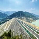
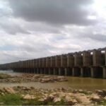
Jayakwadi Dam wasn’t originally supposed to be built where it stands today. The project was first planned for an entirely different location, but after Maharashtra’s formation as a separate state, engineers relocated the entire scheme roughly 100 km upstream to Paithan — while, curiously, keeping the original “Jayakwadi” name even though the site itself had changed completely. Nearly a decade separated its foundation stone, laid by Lal Bahadur Shastri, from its eventual inauguration by Indira Gandhi — two Prime Ministers bookending one of Asia’s longest earthen dams.
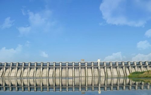
Jayakwadi Dam: Overview
| Parameter | Details |
| State | Maharashtra |
| District | Aurangabad (Sambhajinagar) |
| Taluka | Paithan |
| Location | Jayakwadi village |
| Distance from Aurangabad | Approx. 47 km |
| River | Godavari River |
| Dam type | Earthen dam |
| Height | 41.30 metres (135 ft) |
| Length | 9,998 metres (approx. 10 km) — among the longest earthen dams in Asia |
| Spillway gates | 27 |
| Spillway capacity | 18,153 cubic metres/second |
| Foundation laid | 18 October 1965, by PM Lal Bahadur Shastri |
| Inaugurated | 24 February 1976, by PM Indira Gandhi |
| Reservoir | Nath Sagar Jalashay |
| Reservoir total capacity | 2.909 cubic km (102.75 TMC ft) |
| Reservoir active capacity | 2.17 cubic km (77 TMC ft) |
| Catchment area | 21,750 sq. km |
| Reservoir surface area | 350 sq. km |
| Reservoir dimensions | Approx. 55 km long, 27 km wide |
| Installed power capacity | 12 MW |
| Region served | Drought-prone Marathwada region |
| Part of | Jayakwadi Project (with Stage-II at Majalgaon) |
| Best time to visit | October to February |
The Godavari River: Maharashtra’s “Dakshin Ganga” and Marathwada’s Lifeline
Jayakwadi Dam is built across the Godavari River, often called the “Dakshin Ganga” or Ganges of the South, given its immense length and cultural significance across peninsular India. This particular stretch of the river, near Paithan in Aurangabad district, sits within the Marathwada region — one of Maharashtra’s most persistently drought-affected areas.
A few points about this positioning:
- The reservoir is fed not just by the Godavari but also receives inflow from the Pravara River, giving it a broader catchment reach than the Godavari alone would provide
- Marathwada’s historical vulnerability to drought made a large storage project on the Godavari a strategic priority for the newly formed state of Maharashtra following its 1960 creation
- The dam’s massive catchment area of 21,750 sq. km reflects its position on one of India’s largest rivers, capturing flow from a substantial upstream drainage basin
A Dam That Moved 100 Km But Kept Its Original Name
Jayakwadi’s history contains a genuinely unusual planning twist. The project was originally conceived for a different site, but following the formation of Maharashtra as a separate state and subsequent comparative analysis of alternative locations, planners decided to relocate the dam roughly 100 km upstream to Paithan. Despite this significant site change, the project continued to be called Jayakwadi even after the location shifted.
This relocation wasn’t arbitrary — it was driven by a specific engineering logic:
- Building the dam at a higher elevation upstream made it possible to construct longer canals, extending irrigation benefit to a considerably larger command area than the original site would have allowed
- The project proposal for this relocated scheme was completed by 1964, setting the stage for construction to begin the following year
- This decision reflects a broader pattern in large Indian infrastructure planning, where site selection sometimes evolves significantly between initial conception and final execution, particularly amid major administrative changes like state reorganisation
The project’s extended timeline also spanned a notable political bookend: the foundation stone was laid by Prime Minister Lal Bahadur Shastri on 18 October 1965, but the dam wasn’t inaugurated until 24 February 1976, by Prime Minister Indira Gandhi — over a decade later, and under an entirely different national leadership than when the project began.
Engineering Specifications: One of Asia’s Longest Earthen Dams
Jayakwadi Dam’s most striking engineering feature is its sheer length. Stretching approximately 10 km (9,998 metres), it is frequently cited as one of the longest earthen dams anywhere in Asia — an extraordinary scale reflecting the wide, relatively flat valley section of the Godavari at this particular site.
Core specifications:
- Height: 41.30 metres (135 ft)
- Length: approximately 9,998 metres (10 km)
- Spillway: 27 gates, with a discharge capacity of 18,153 cubic metres per second
- Reservoir total capacity: 2.909 cubic km (102.75 TMC ft)
- Reservoir active capacity: 2.17 cubic km (77 TMC ft)
- Reservoir dimensions: approximately 55 km long and 27 km wide at full capacity
This combination of moderate height and exceptional length is a direct consequence of the relatively flat terrain surrounding Paithan — rather than a narrow gorge, the Godavari here flows through open country, requiring an unusually long embankment to create a reservoir of this scale.
What Nath Sagar Actually Supplies
The reservoir created by Jayakwadi Dam, known as Nath Sagar Jalashay, serves a genuinely multipurpose mandate central to Marathwada’s water security:
- Irrigation: Supplying water to agricultural land across the drought-prone Marathwada region, a transformative benefit for an area that has historically struggled with unreliable rainfall
- Drinking and industrial water supply: Serving nearby towns and villages, along with the municipalities and industrial areas of Sambhajinagar (Aurangabad) and Jalna districts
- Hydroelectric power: Generating 12 MW through the dam’s associated power station
- Recreation and ecology: The surrounding area includes a garden and a bird sanctuary, adding a recreational and ecological dimension to the site beyond its core infrastructure role
Given how central this dam is to drinking water supply for a major city like Sambhajinagar, its water levels are closely monitored each year, particularly during weaker monsoon seasons when Marathwada’s broader drought vulnerability becomes most apparent.
Jayakwadi Stage-II: The Majalgaon Extension
Jayakwadi Dam doesn’t stand alone within its broader irrigation scheme. A second stage of the project, officially known as the Jayakwadi Stage-II Dam, was built at Majalgaon across the Sindphana River, a major tributary of the Godavari, completed in 1987.
Key details about this extension:
- Height: 31.19 metres, Length: 6,488 metres
- Irrigation reach: a 165 km canal system irrigating 93,885 hectares across Beed, Parbhani, and Nanded districts
- Power generation: three 750 kW turbines for a combined capacity of 2,250 kW
- Displacement impact: construction affected 34 villages, with 18 fully submerged and 2 partially inundated, submerging a total of 7,813 hectares of land, though no forest land was affected
This two-stage structure — Jayakwadi’s main dam at Paithan feeding into the broader Marathwada irrigation network, complemented by the Majalgaon extension further along the Sindphana tributary — reflects a coordinated, large-scale approach to addressing this historically drought-prone region’s water needs.
Planning a Visit to Jayakwadi Dam
For anyone considering a trip:
- Getting there: The dam sits roughly 47 km from Aurangabad, accessible by road
- Best season: October through February offers the most comfortable weather and typically the fullest reservoir following the monsoon
- What to see: The surrounding garden and bird sanctuary offer a pleasant complement to the dam’s impressive scale, along with boating facilities at the site
- Combine with Paithan’s heritage: Given Paithan’s own historical and cultural significance, including its association with traditional Paithani sarees, visitors can pair a dam visit with broader regional sightseeing
FAQs
Q1. Why does Jayakwadi Dam still carry that name if it was actually built at a different location than originally planned?
The project retained its original “Jayakwadi” name even after being relocated approximately 100 km upstream to Paithan, a decision made because moving the site upstream allowed for longer canals and a significantly larger irrigation command area.
Q2. Why did it take over a decade between the foundation stone being laid and the dam’s actual inauguration?
The extended timeline, spanning from Lal Bahadur Shastri’s 1965 foundation ceremony to Indira Gandhi’s 1976 inauguration, reflects the genuine scale and complexity of constructing one of Asia’s longest earthen dams across a wide, relatively flat stretch of the Godavari River.
Q3. Is Jayakwadi Dam connected to the Majalgaon Dam, or are they entirely separate projects?
They’re connected as part of the same broader scheme — Majalgaon Dam is officially known as the Jayakwadi Stage-II Dam, built later on the Sindphana tributary to extend irrigation benefit further across Beed, Parbhani, and Nanded districts.
Q4. Does Jayakwadi Dam’s water reliably reach Aurangabad city even during weak monsoon years?
While the dam serves as a major drinking water source for Sambhajinagar (Aurangabad) and Jalna districts, reservoir levels can fluctuate significantly with monsoon performance, meaning water availability during particularly dry years can become a genuine local concern requiring careful management.