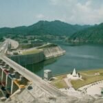
Rihand Dam generates just 300 MW of electricity — a modest figure by the standards of India’s major hydroelectric projects. Yet this same dam is arguably one of the most economically consequential pieces of infrastructure in northern India, because its reservoir supplies cooling water to a cluster of coal-fired power plants that together generate over 10,000 MW for the national grid, earning the surrounding district the nickname “Energy Capital of India.”
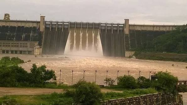
Rihand Dam: Overview
| Parameter | Details |
| State | Uttar Pradesh |
| District | Sonbhadra |
| Location | Pipri |
| Official reservoir name | Govind Ballabh Pant Sagar |
| River | Rihand River, a tributary of the Son River |
| Dam type | Concrete gravity dam, built in 61 independent structural blocks |
| Height | 91.44–91.46 metres (300 ft) |
| Length | Approx. 934.45 metres (3,066 ft) |
| Construction began | 1953–1954 |
| Year completed | 1962 |
| Named after | Govind Ballabh Pant, freedom fighter and former Chief Minister of Uttar Pradesh |
| Reservoir total capacity | 10.6 billion cubic metres |
| Reservoir surface area | Approx. 466–468 sq. km |
| National ranking | Second-largest dam in India by storage volume, after Indira Sagar Dam |
| Catchment area | 13,333 sq. km, spanning UP, Madhya Pradesh, and Chhattisgarh |
| Installed power capacity | 300 MW (6 x 50 MW Francis turbines) |
| Spillway | 13 Tainter gates, Ogee type |
| Key regional role | Cooling water source for a major thermal power cluster generating over 10,000 MW |
| Downstream benefit | Irrigation water supply extending to Bihar |
| Best time to visit | October to February |
The Rihand River and a Three-State Catchment
Rihand Dam sits across the Rihand River, a tributary of the Son River, which itself eventually joins the Ganga. The dam’s catchment spans a genuinely wide area, extending across parts of Uttar Pradesh, Madhya Pradesh, and Chhattisgarh — a three-state drainage basin covering 13,333 sq. km.
A few points about this river system’s significance:
- Water from the reservoir ultimately supports irrigation not just in the immediate Sonbhadra and Mirzapur region but extends downstream to benefit agricultural areas in Bihar as well
- This multi-state catchment reflects the Rihand’s position within the broader Son-Ganga river network, giving the dam relevance well beyond Uttar Pradesh’s own borders
- The reservoir itself straddles the border between Uttar Pradesh and Madhya Pradesh, adding a genuine interstate dimension to its geography even though the dam structure and primary operation fall under Uttar Pradesh
History: From British Colonial Interest to Nehru-Era Completion
Interest in damming the Rihand River dates back further than India’s independence — British colonial authorities were considering a dam at this location as early as 1940, recognising the site’s potential for both irrigation improvement and hydroelectric power generation. This early colonial-era interest, however, never progressed to actual construction.
The project only moved forward after independence, as part of Prime Minister Jawaharlal Nehru’s broader vision of river valley development as an engine of national economic growth:
- The independent Indian government sanctioned formal survey work in 1952
- Construction began in 1953–1954 and continued for roughly eight years
- The dam was completed in 1962, becoming, at the time, the largest dam in India by volume of concrete used
- Construction required clearing forests and relocating villages, involving genuine large-scale resettlement — though specific detailed figures for the number of families affected aren’t consistently documented in accessible public sources
The reservoir created was later named Govind Ballabh Pant Sagar, honouring a prominent Indian freedom fighter who had also served as Chief Minister of Uttar Pradesh — a naming choice that tied this major post-independence infrastructure achievement directly to India’s independence movement legacy.
Engineering Specifications: 61 Concrete Blocks
Rihand Dam is built as a concrete gravity structure, standing 91.44 to 91.46 metres (300 ft) tall and stretching approximately 934.45 metres (3,066 ft) in length. A distinctive feature of its construction is that the entire structure was built using 61 independent structural blocks, a modular design approach that allows for better stress distribution and easier long-term maintenance compared to a single continuous concrete pour.
Core specifications:
- Height: 91.44–91.46 metres (300 ft)
- Length: approximately 934.45 metres (3,066 ft)
- Construction design: 61 independent concrete structural blocks
- Spillway: 13 Tainter gates, Ogee type
- Reservoir total capacity: 10.6 billion cubic metres
This scale places Rihand as the second-largest dam in India by storage volume, trailing only Indira Sagar Dam in Madhya Pradesh — a genuinely significant national ranking for a structure whose power generation capacity remains comparatively modest.
India’s Largest Artificial Lake and a Modest Power Output
The reservoir Rihand Dam created, Govind Ballabh Pant Sagar, was India’s largest artificial lake at the time of the dam’s construction, spreading across approximately 466 to 468 sq. km. Its installed power generation capacity, by contrast, is a relatively modest 300 MW, produced through six 50 MW Francis-type turbines.
This gap between the reservoir’s massive scale and its comparatively limited direct power output is worth understanding clearly:
- Many dams of comparable reservoir size generate substantially more electricity directly
- Rihand’s true economic significance lies not in its own generation figures but in the role its water plays in supporting an entirely separate, much larger power generation ecosystem nearby
The Real Value: Cooling Water for a 10,000 MW Thermal Cluster
Rihand Dam’s genuine strategic importance becomes clear once its relationship with Sonbhadra’s thermal power industry is understood. Govind Ballabh Pant Sagar supplies critical cooling water to one of the largest clusters of coal-fired thermal power plants in India, including major facilities at Singrauli, Vindhyachal, and Anpara.
A few points about this hydel-thermal symbiosis:
- Combined, these thermal plants generate over 10,000 MW of electricity for the Northern Grid, dwarfing Rihand Dam’s own direct 300 MW output by more than 30 times
- This relationship has transformed Sonbhadra, once a remote and economically underdeveloped, mineral-rich region, into what’s now widely described as the “Energy Capital of India”
- This case represents a genuinely instructive example in resource geography and industrial planning: a dam’s true developmental value doesn’t always show up in its own turbine specifications, but in the broader industrial ecosystem its water sustains
This symbiotic relationship between hydroelectric infrastructure and thermal power generation is relatively uncommon at this scale elsewhere in India, making Rihand Dam a genuinely distinctive case study for understanding how water infrastructure can anchor entire regional industrial economies.
Environmental Concerns in the Energy Capital
The same concentration of thermal power plants that gives Rihand Dam its outsized economic significance has also brought genuine environmental challenges to the region. Water pollution concerns linked to this dense industrial cluster have been documented around Sonbhadra, reflecting the broader trade-offs that come with concentrating this much coal-based power generation in a single geographic area.
A few points about this dimension:
- The reservoir’s role as both a scenic natural asset and an industrial water source creates an inherent tension between conservation and continued industrial reliance on the same water body
- This environmental dimension is worth understanding alongside the more celebratory “Energy Capital” narrative often applied to the region, offering a fuller, more balanced picture of Rihand’s regional impact
Planning a Visit to Rihand Dam
For anyone considering a trip:
- Getting there: The dam sits near Pipri in Sonbhadra district, accessible by road
- Best season: October through February offers the most comfortable weather and typically the fullest reservoir following the monsoon
- What to see: The vast expanse of Govind Ballabh Pant Sagar, surrounded by greenery, offers genuinely scenic views suited to photography and nature walks
- What to expect: Given the region’s industrial character, visitors should anticipate a landscape that combines natural reservoir scenery with visible thermal power infrastructure nearby, reflecting Sonbhadra’s dual identity as both a scenic destination and an industrial energy hub
FAQs
Q1. Why is Rihand Dam’s power output so much smaller than its massive reservoir size would suggest?
Rihand Dam’s own installed capacity of 300 MW is genuinely modest for a reservoir of its scale, but its real economic value lies in supplying cooling water to a much larger nearby cluster of coal-fired thermal power plants that together generate over 10,000 MW, rather than in its own direct hydroelectric generation.
Q2. Is Govind Ballabh Pant Sagar still India’s largest artificial lake today?
It held this distinction at the time of the dam’s construction, and while other large reservoirs have since been built elsewhere in India, Govind Ballabh Pant Sagar remains one of the country’s largest artificial lakes by surface area.
Q3. Why is Sonbhadra district called the “Energy Capital of India”?
This nickname reflects the concentration of major thermal power plants, including those at Singrauli, Vindhyachal, and Anpara, all relying on cooling water supplied by Rihand Dam’s reservoir, making the district collectively responsible for a substantial share of northern India’s electricity supply.
Q4. Are there environmental concerns associated with visiting or living near Rihand Dam’s reservoir?
Yes — the dense concentration of thermal power plants relying on the reservoir’s water has raised documented water pollution and broader environmental concerns in the region, which is worth keeping in mind alongside the area’s genuine scenic and industrial significance.