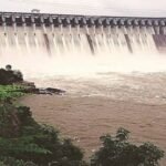
Every year around Ashadhi Ekadashi, when lakhs of Warkari pilgrims converge on Pandharpur to bathe in the Chandrabhaga River before the Vitthal temple, one decision taken nearly 200 km upstream can turn their sacred dip into a safety emergency. That decision belongs to the operators of Ujjani Dam, whose water releases into the Bhima River directly shape river conditions at Pandharpur — sometimes forcing authorities to ban river bathing altogether during the very festival the river is famous for hosting.

Ujjani Dam Overview
| Parameter | Details |
| State | Maharashtra |
| District | Solapur (dam site), with reservoir extending into Pune district |
| Nearest village | Ujani, Madha taluka |
| Also known as | Bhima Dam, Bhima Irrigation Project |
| River | Bhima River, a tributary of the Krishna River |
| Reservoir name | Yashwant Sagar |
| Dam type | Composite — earthfill cum masonry gravity dam |
| Height | 56.4 metres (185 ft) |
| Length | 2,534 metres (approx. 2.5 km) |
| Spillway (central) length | 602 metres |
| Number of spillway gates | 41 |
| Gross storage capacity | 110.89 TMC (approx. 3.14 billion cubic metres) |
| Live/active storage | Approx. 53 TMC |
| Dead/inactive storage | Approx. 59 TMC |
| Catchment area | 14,850 sq. km |
| Reservoir surface area | 337 sq. km |
| Installed power capacity | 12 MW (pumped-storage hydro) |
| Construction period | 1969 to June 1980 |
| Owner/operator | Government of Maharashtra, Water Resources Department |
| Villages affected by submergence | Approx. 82 |
| Downstream significance | Feeds the Chandrabhaga River near Pandharpur |
| Best time to visit | October to February |
One River, Two Names, and a Pilgrimage in Between
The Bhima River, which Ujjani Dam impounds, is itself a tributary of the mighty Krishna and originates near the Bhimashankar Jyotirlinga temple in the Western Ghats. But somewhere near Pandharpur, roughly 100 km downstream of the dam, the river takes on a different identity entirely — it curves into a crescent shape and becomes known as the Chandrabhaga, the river at the heart of one of Maharashtra’s most significant pilgrimage traditions.
This dual identity matters enormously for how the dam is operated. During the monsoon months leading up to Ashadhi Ekadashi, Ujjani’s water management decisions ripple straight into Pandharpur’s religious calendar:
- Heavy inflows into the reservoir often force pre-emptive releases to keep the dam within safe operating levels
- These releases raise the Chandrabhaga’s water level just as thousands of Warkari pilgrims are arriving for the annual Wari procession
- In recent years, discharges from Ujjani have reached anywhere from 35,000 to over 1.5 lakh cusecs during peak monsoon periods, occasionally submerging riverside temples and forcing bans on ritual river bathing
- Authorities have had to deploy rescue boats and issue repeated warnings to pilgrims to stay clear of the rising water
This isn’t a rare coincidence — it happens with enough regularity that Maharashtra’s disaster management machinery now treats the pre-Wari period as a standing watch on Ujjani’s discharge schedule.
A Project Born from the Need to Tame the Bhima
Construction on Ujjani Dam began in 1969, and the project took over a decade to complete, finally becoming operational in June 1980. The scale of the undertaking reflected the scale of the problem it was meant to solve: the Bhima basin’s rainfall is highly seasonal, leaving downstream areas of Solapur district — one of Maharashtra’s more drought-prone regions — dependent on a river that could swing between flood and near-dry conditions within the same year.
A few historical points worth noting:
- The dam is located near Ujani village in Madha taluka of Solapur district, though its massive reservoir stretches back into Indapur taluka of Pune district
- Its construction displaced residents from roughly 82 villages, a submergence footprint that remains one of the larger resettlement chapters in Maharashtra’s dam-building history
- The project was designed from the outset as multipurpose — irrigation, water supply, hydroelectric power, and flood moderation — rather than serving a single function
Engineering Details: Height, Length, and a Composite Design
Ujjani Dam’s structure reflects a hybrid engineering approach common to large Indian river-valley projects of its era. It combines an earthfill embankment with a masonry gravity section, standing 56.4 metres tall and stretching 2,534 metres across the Bhima valley. At the centre of this length sits a 602-metre spillway section fitted with 41 gates, which handles the dam’s flood discharge — the same gates responsible for those headline-making releases during monsoon season.
Key engineering figures:
- Height: 56.4 metres above the lowest foundation
- Total length: 2,534 metres
- Spillway length: 602 metres, with 41 controlling gates
- Foundation: built on massive basaltic rock formations typical of the Deccan plateau
This composite design — part earthen embankment, part concrete-and-masonry spillway — allowed engineers to seal off a wide river valley economically while still providing the controlled discharge capacity needed to manage a river with such unpredictable monsoon behaviour.
The Reservoir’s Unusual Storage Arithmetic
Here’s a detail that surprises many people learning about Ujjani Dam for the first time: of its total 110.89 TMC storage capacity, dead storage (water that sits below the level from which it can be drawn out for use) actually exceeds live storage — roughly 59 TMC of dead storage against about 53 TMC of usable, active storage.
This has real consequences for how the dam performs during drought years:
- A large share of the reservoir’s total volume is effectively locked away and unusable for irrigation or supply
- During weak monsoon years, the gap between “the dam looks fairly full” and “the dam has usable water” can be considerable, a distinction that regularly features in local drought reporting
- This storage structure is part of why Ujjani has occasionally struggled to fully meet competing demands from Solapur, Pune, and Ahmednagar districts during dry years
The reservoir itself, named Yashwant Sagar, spans a surface area of 337 sq. km at full capacity and draws from a catchment stretching across 14,850 sq. km — a large drainage area that makes the dam highly sensitive to rainfall patterns across the entire Upper Bhima basin, not just local Solapur rainfall.
Power Generation: A Pumped-Storage Approach
Ujjani Dam’s power station is designed as a pumped-storage facility with 12 MW of installed capacity, using reversible pump turbines that can both generate electricity from released water and pump water back up during off-peak periods. When the project was first planned, annual generation estimates ran as high as 105 GWh; in practice, actual output has settled closer to 21 GWh in most years, as irrigation demands have consistently taken priority over power generation in how released water gets allocated.
This trade-off is worth understanding for anyone studying the dam’s operations:
- Irrigation needs across Solapur, Pune, and parts of Ahmednagar districts generally take precedence over maximising power output
- Power generation effectively happens as a secondary benefit of water already being released for irrigation or flood control, rather than driving release decisions independently
Why Water From This Dam Sparks Regular Political Disputes
Ujjani Dam’s water isn’t just an engineering resource — it’s a recurring flashpoint in local politics. In 2021, a state government order to allocate 5 TMC of Ujjani water to Indapur and Baramati in Pune district triggered street protests in Solapur, with local legislators threatening resignations and demonstrations reaching as far as Baramati itself. The state ultimately withdrew the order following the backlash.
This kind of dispute tends to resurface whenever water becomes scarce, for a straightforward reason:
- Solapur district, historically drought-affected, views Ujjani’s water as essential to its own agricultural and drinking water security
- Neighbouring Pune district areas within the reservoir’s catchment also stake a claim to water from a dam whose reservoir extends into their territory
- Allocation decisions during dry years routinely draw scrutiny from farmers’ groups and local political representatives on both sides
Visiting Ujjani Dam
For anyone planning a trip, a few practical points:
- The dam and its reservoir are accessible from both Solapur and nearby towns in Pune district, given the reservoir’s spread across the district border
- Bird activity around the reservoir’s shallower edges can be worth watching during winter months, though it isn’t as developed a birding destination as some other Maharashtra dam sites
- Visiting during or immediately after heavy monsoon discharge periods should be approached with caution, particularly given the dam’s history of large, sudden releases
- Combining a Ujjani visit with a trip to Pandharpur, roughly two to three hours away by road, offers useful context on how directly the two places are connected through the same river system
FAQs
Q. Why does water released from Ujjani Dam affect a pilgrimage town so far downstream?
The Bhima River that Ujjani impounds becomes the Chandrabhaga near Pandharpur, so any significant release from the dam during monsoon season directly raises water levels at the very stretch of river where pilgrims gather for ritual bathing.
Q. Is Ujjani Dam’s water shared between Solapur and Pune districts, and does this cause conflict?
Yes — the reservoir extends into Pune district’s Indapur taluka even though the dam site sits in Solapur, and allocation decisions between the two districts have triggered public protests in the past, particularly during years of water scarcity.
Q. Why is the dam’s dead storage larger than its usable storage?
This is a structural feature of the reservoir’s design rather than a flaw, but it means a substantial portion of the total capacity sits below the drawable level, which can make the reservoir look fuller than the water actually available for irrigation or supply during dry spells.
Q. Is it safe to visit the Chandrabhaga River in Pandharpur during the monsoon season?
Caution is strongly advised during this period, since scheduled or emergency releases from Ujjani Dam can raise river levels quickly, and local authorities regularly restrict river bathing when discharge rates are high.